Trail Area
Turracher Höhe

Biking with the gang

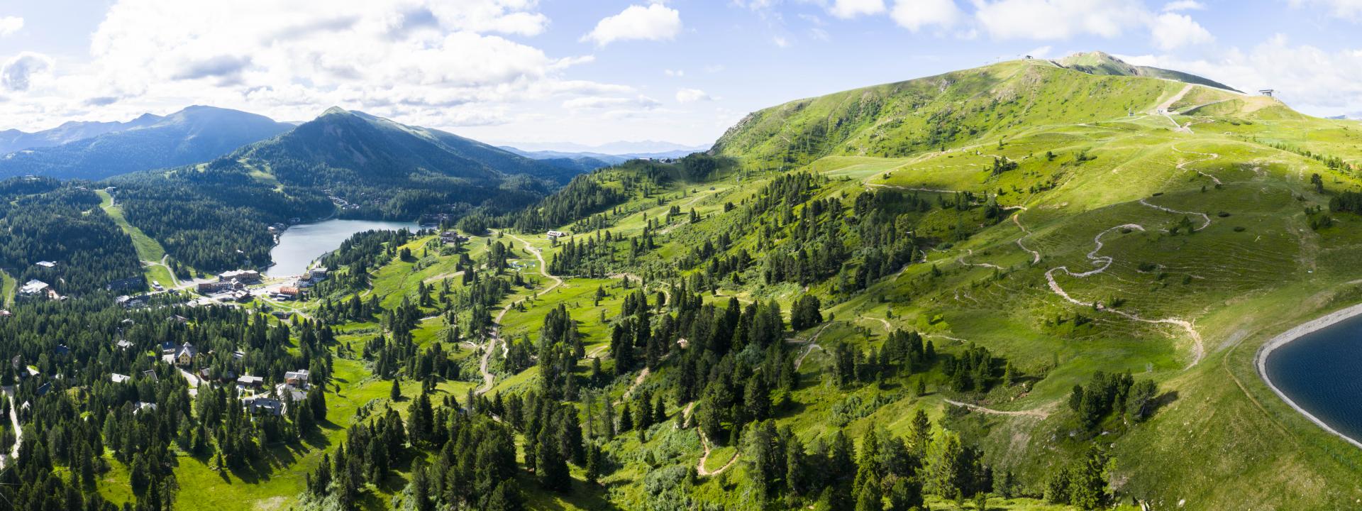
The rocking highlight of the Turracher Höhe Trail Area is arguably the versatile 8 kilometer Kornock Trail, offering a panorama that has it all. Views over the lush green meadows of the Styrian-Carinthain Nockberge mountains that alternate with the turquoise glittering waters of Lake Turracher See delight time and again.

Descending from the top of the Kornock ski piste, the trail itself features just two sections that are technically more demanding. However, basic bike handling skills and a good level of fitness are required to fully enjoy this varied path. Those who are technically not experienced enough should therefore first practice the right trail technique with the bike guides in the valley.

A number of rest areas along the trail invite to refuel energy and enjoy the fabulous views of the surrounding Nockberge mountains and Lake Turracher See. Just after the Schafalmbahn, riders are taken on a roller coaster like experience over rollable waves and jumps, fun berms, paths, bridges and a small curve carousel. Shortly before you get to the Almstube inn there is a not too long uphill section

Turracher Höhe has a lot in store for avid bikers: see our interactive trail map for an overview of the biking offer in the Turracher Höhe Trail Area.

Trail Offer

The varied routes at a glance

Trail Ticket Rates 2024

for ascents with the Kornockbahn

Single and day tickets

Adults

Children (2009-2017)

Ascent including bike transport22,5013,50
4-hours ticket35,0021,00
Day ticket41,0024,50
Bike transport9,509,50

Multi-day tickets

Adults

Children (2009-2017)

2 days78,0047,00
3 days116,0069,50
4 days153,0092,00
5 days185,00111,00
Season Ticket 328,00197,00

Gravity Card - 31 bike parks with one single ticket

season pass

Adults 

Youth (2005-2007)

Child (2008-2017)

Gravity Card 2024629,00469,00315,00
Turracher Höhe

From July until End of September

Operating hours 2024

June 29 until September 8, 2024
9:00 a.m. - 4:00 p.m.

September 9 until End of September 2024 (depending on weather conditions)
Sat & Sun from 9:00 a.m. - 4:00 p.m.

From July until End of September

Operating hours 2024

June 29 until September 8, 2024
9:00 a.m. - 4:00 p.m.

September 9 until End of September 2024 (depending on weather conditions)
Sat & Sun from 9:00 a.m. - 4:00 p.m.

Turracher Höhe
Turracher Höhe
Turracher Höhe
Turracher Höhe
Turracher Höhe
Turracher Höhe
Turracher Höhe
Turracher Höhe
Turracher Höhe

Right behavior

when mountain biking

  • Always bring helmet, knee and elbow pad with you
  • Ride only with a technically perfect MTB or e-MTB
  • Cycling uphill or hiking on the trails is forbidden
  • Using the trails is only permittedduring the cable car operating hours
  • Use only the marked trails. Is prohibited to rideon „not bike routes“
  • Respect the prohibition signs and notethe signs
  • Follow the instructions of the cable car and route staff
  • Adapt the duration/lenght of the track according to the meteorological condition
  • Pay attention to other persons when entering and exiting on shared paths and intersections
  • Control the speed so that you can stop at any time
  • Respect the trails, other interests, users and nature! Expect wild and domestic animals on the trails

Driving on the trails is at your own risk. No liability is accepted for accidents or damage to the bike or the equipment. The StVO must be observed when driving on public roads.


Turracher Höhe

Bike Wash & Service

  • Kornockbahn valley station: end of Kornock Flowtrail
  • Huskies bike rental
  • Intersport Brandstätter / opposite pump track practice lift
  • Service at all bike shops and select hotels

Trail Difficulty Rating

  • Turracher Höhe

    Very easy

    Technical difficulty S0

    next

    Very easy

    Turracher Höhe

    Mostly flat and easy trails which are physically not very demanding. Riders should be fit and have a basic knowledge of key bike handling skills.

    Very easy = green

    • Average gradient: 6% max.
    • Gradient over 20 - 30 m max.: 15% max.
    • Trail width: minimum 1 m
    • Curve radius: minimum 3 m

    Technical requirements according to the single trail scale: S0 describes a single trail without any particular difficulties. Mostly forest or meadow paths on a natural surface with good grip, or compact gravel. Steps, rocks or roots are not to be expected.

    Required biking ability: basic trail technique such as position on the bike, tackling curves and braking on loose surface.

  • Turracher Höhe

    Easy

    Technical difficulty S1

    next

    Easy

    Turracher Höhe

    Flow or single trails can be easy. However, an easy trail might be as much as twice as steep as a trail rated very easy, with moderate fitness and coordination requirements. Basic biking technique skills are required to tackle the trail.

    Easy = blue

    • Average gradient: 10% max.
    • Gradient over 20 - 30 m max: 30%.
    • Trail width: minimum 0.8 m
    • Curve radius: minimum 3 m
    • Trail can be in steeper terrain.

    Technical requirements according to the single trail scale: On a trail marked S1 you already have to deal with smaller obstacles such as flat roots, small stones and isolated gulleys. The maximum gradient is 30%. Switchbacks are not to be expected. S1 flow trails have additional rollers and banked corners.

    Required biking abilities: basic trail technique such as position on the bike, riding banked turns, cornering, controlled braking on loose surface and weight shifting.

  • Turracher Höhe

    Moderately difficult

    Technical difficulty S1-S2

    next

    Moderately difficult

    Turracher Höhe

    Flow trails with an average gradient of > 10% are classified as moderate and S1.
    Jump trails are a more difficult version of flow trails with moderate to difficult elements such as steeper banked turns, jumps, gaps, step ups, step downs, shark fins and other elements which also may consist of wood and other materials.

    Intermediate = red

    Moderate single trails beckon with technical challenges such as narrow curves, larger roots, mostly optional jumps and technical elements like stone gardens, rock drops etc. Requires a fair amount of fitness and coordination skills. On an average 20 up to 50% steeper than easy trails.

    • Average gradient: 10% up to 15% max.
    • Gradient over 10 to 30m: 60% max.
    • Single trail trail width: minimum 0.6 m
    • Jumpline trail width: minimum 1.5 m
    • Curve radius: minimum 2 m

    Trail can be in steeper terrain.

    Technical requirement: On S1 trails, you will already have to deal with smaller obstacles such as flat roots, small stones and isolated gullies. The maximum gradient is 30%. Switchbacks are not to be expected. Within the S2 single trail classification you will most likely find trails with larger roots, stones, steps, flat staircases and narrow curves. In some passages, the gradient can reach up to 60%.

    Required biking abilities: advanced MTB riding skills including the ability to brake at all times and keep body tension. Good weight shifting to overcome obstacles as well as advanced trail and jump technique.

  • Turracher Höhe

    Difficult

    Technical difficulty S3 to S5

    next

    Difficult

    Turracher Höhe

    Very difficult single trails with extremely high technical challenge.

    Difficult = black

    • Average gradient: minimum 20%
    • Gradient over 20 up to 30 m max.: 60% max.
    • Trail width: < 0,6 m max.
    • Curve radius : < 2 m max.

    The trail runs mostly through steep terrain or is built technically demanding in flat terrain.

    Technical requirement: on single trails graded S3 up to S5, riders have to be prepared for difficult to extreme challenging obstacles and passages. S3 describe blocked single trails with large boulders, root passages, high steps, loose gravel and tricky traverses. Steep slopes over 70% and extreme exposure are not uncommon.

    Required biking abilities: advanced to professional trail technique. Requirements include excellent balance, the ability to shift the rear wheel and outstanding braking.